Jacques Cartier's First Voyage to the New World
1534 · Saint-Malo, France
Jacques Cartier sets sail on his first voyage to the New World, commissioned by King Francis I of France to explore the northern lands, which would later become Canada.
April 25, 1507
The world map produced by German cartographer Martin Waldseemüller was published, which was the first to use the name 'America' in honor of explorer Amerigo Vespucci.
Saint-Dié-des-Vosges, France | Gymnasium Vosagense
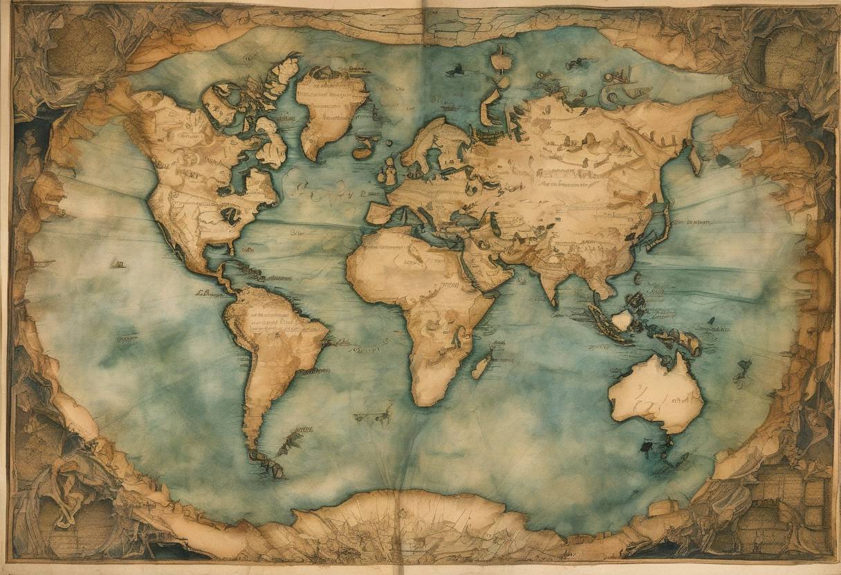
On April 25, 1507, a groundbreaking world map was published by the German cartographer Martin Waldseemüller. This map is historically significant as it was the first to use the name “America,” in honor of the Italian explorer Amerigo Vespucci.
During the early 16th century, European exploration of the New World was rapidly expanding. Christopher Columbus’s voyages had already opened the door to the Americas, but it was Amerigo Vespucci’s accounts of his travels that provided a new understanding of these lands as separate from Asia. Vespucci’s letters described the lands he explored as a “New World,” distinct from the previously known continents of Europe, Asia, and Africa.
Martin Waldseemüller was part of a group of scholars known as the Gymnasium Vosagense, based in Saint-Dié-des-Vosges, in present-day France. Inspired by Vespucci’s accounts, Waldseemüller and his colleagues set out to create a map that accurately represented the newly discovered lands.
The map, titled “Universalis Cosmographia,” was a large wall map measuring approximately 4.5 by 8 feet. It was printed using woodcut techniques and was accompanied by a book called “Cosmographiae Introductio,” which explained the map and the rationale behind naming the new continent “America.”
The decision to name the continent “America” was based on Vespucci’s contributions to the understanding of the New World. In the “Cosmographiae Introductio,” Waldseemüller wrote:
“I do not see what right anyone would have to object to calling this part America, after Amerigo, its discoverer, a man of great ability.”
This was a significant departure from the tradition of naming new lands after monarchs or saints, and it marked a shift in recognizing the contributions of explorers.
The Waldseemüller map was widely distributed, with about 1,000 copies printed, though only one known copy survives today, housed in the Library of Congress in Washington, D.C. The map’s use of “America” gradually gained acceptance, and by the mid-16th century, the name was commonly used to refer to the continents of the Western Hemisphere.
The map is also notable for its depiction of the world, which included a separate western hemisphere and a surprisingly accurate representation of the South American coastline, reflecting the latest geographical knowledge of the time.
The publication of Martin Waldseemüller’s map on April 25, 1507, marked a pivotal moment in cartography and the history of exploration. By naming the new continent “America,” Waldseemüller not only honored Amerigo Vespucci but also contributed to the evolving understanding of the world’s geography. This map remains a testament to the spirit of discovery and the transformative power of exploration during the Age of Discovery.
Source: en.wikipedia.org